The Master of Rasina and Župa
As you head west from Aleksandrovac, along the road that leads over the northern edge of the Kopaonik massif to the Jošanička Banja and further into the Ibar River valley, you will come across an imposing hill, on top of which rise the remains of the fortified city of Koznik. Known as a fortress with one of Serbia’s most geographically prominent locations, Koznik is also regarded as one of the most preserved and most beautiful achievements of Serbian medieval defence construction. As with the majority of fortified cities from that period, little is known about the origins of Koznik, but the lack of historical data is compensated by numerous interesting tales and legends, which have inspired the imagination of travellers and travel writers for centuries until today.
The exact time when the city was founded is not known. It is presumed that it was built in the second half of the 14th century, in times of intensified attacks by the Ottomans, as the seat of one of the powerful Serbian nobles. A folktale says it was founded by Jerina the Cursed and constructed by the builder Najdan. The outstanding strategic position at the intersection of the Župa’s vineyards with the mountain massifs of Kopaonik and Željin enabled Koznik to dominate the valley of Rasina and the important route that passed through it. The first mention of the noble Koznik in historical sources was in the charter Prince Lazar issued to the Lavra Saint Athanasius on the Holy Mountain in 1381, granting this monastery an annual help of 100 litres of silver. It is known that in 1402, Princess Milica resided in Koznik, and three years later, her son, Despot Stefan Lazarević.
ABOVE: Map of the site

ABOVE: The remains of the upper town were surrounded by a rampart with eight defensive towers
It is considered that the town became the Rasina district’s centre at the end of the 14th and the beginning of the 15th centuries. It was fortified and used by the then district sovereign, lord Radič Postupović, the čelnik (a high court title) of the Despot Stefan Lazarević, and later the grand čelnik (count palatine) of the Despot Đuradj Branković. The properties of the nobleman Radič, who was also a big founder, were scattered all over Serbia. It was recorded that Despot Đuradj verified the estates Radič had during Despot Stefan’s rule, among which were two villages close to Koznik: Budilovina and Milentija. Remembered for his courage, determination, and wisdom, Radič Postupović was sung in epic folk poetry under the names of Rade Oblačić, Oblak Radosav, and Rajko of Rasina.

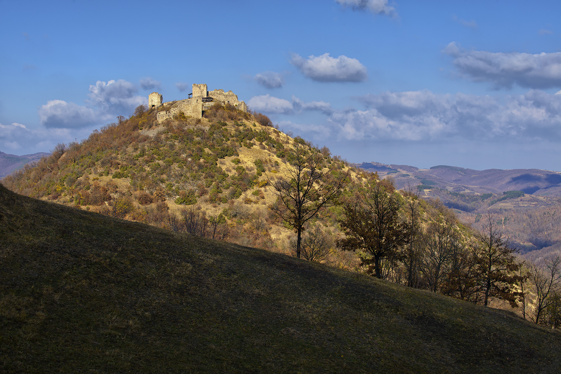
ABOVE: Koznik was built on a steep, conical tump at an altitude of 920 meters
The Ottomans seized Koznik in 1433, briefly returning it to Despot Đuradj Branković in 1444 and again in 1451. Due to its strategic position, the town was neither burnt to the ground nor demolished, unlike many nearby fortifications. Until the second half of the 16th century, a permanent military crew remained stationed in the fortress. Due to the breakthrough of the Ottomans into Central Europe, the border moved further north, and Koznik lost its significance. At the end of the 17th century, that is, in 1689., Koznik was seized by Serbian rebels, indicating that it remained an active fortification at that time. Even after that event, the Koznik nahiya (district) existed until the early 19th century. Following the liberation from the Ottomans, the Koznik county was established with its administrative seat in Brus.


ABOVE LEFT: View from the fortress to the Rasina River valley
ABOVE RIGHT: The remains of one of the smaller, eastern towers that was used for the circumference wall reinforcement
Koznik belongs to a group of fortifications established during the times of Moravian Serbia. Unlike most of the cities from that period, such as Kruševac, Stalać, and Smederevo, which were erected near plains, Koznik, according to old construction practices, was built on a steep, conical hill at an elevation of 920 meters. The town’s layout was irregular, with eight towers of varying dimensions and a robust rampart that followed the configuration of the terrain. The two largest towers, located on the northern side, served both defensive and residential purposes, while the one considered a keep was originally four stories tall, reaching a height of 18 meters. The northwestern tower, initially intended as a gate tower, was walled up during construction so that the only entrance was on the northeastern wall.


ABOVE LEFT: Northwestern tower in which the entrance was walled up during construction
ABOVE RIGHT: Detail of the northwest tower wall
In the southern part of the fortification, a brick-tiled fireplace and the town’s water supply system were situated. Atmospheric water was collected in a circular cistern with a diameter of five meters, which was internally insulated with a thick layer of clay. The cistern contained four wells built with slab stones, with the interspace between them filled by a gravel filter. Notably, during the site’s exploration, three of the four wells still contained clear water.


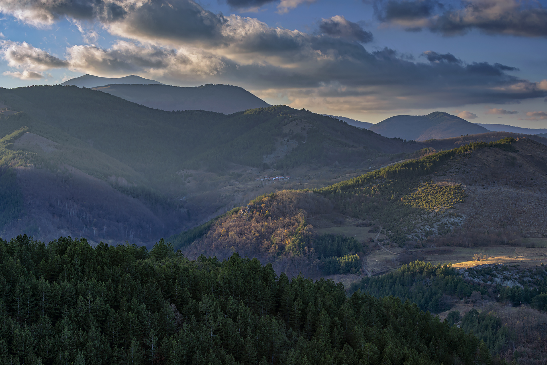
ABOVE LEFT: View from Koznik to the Kopaonik and Željin mountain tops
ABOVE RIGHT: The view from the highest part of the town reaches all the way to the Rtanj pyramid on the east
The abundance of mobile archaeological material, including elements of Moravian-style architectural ornamentation, fresco fragments, and a skeletal grave located on the exterior side of the wall, suggests the presence of a church at the site of a partially explored structure in the northeastern sector of the town. This building dates to the earliest phase of construction, specifically the second half of the 14th century. South of the fortress, on a gentle slope, lies a suburbium (outer settlement) with a square and a defensive tower, the remains of which are still partially visible today. Archaeological excavations and conservation efforts at the fortress have been carried out on several occasions. The unearthed artefacts are now housed in the National Museum of Kruševac and the Institute for the Protection of Cultural Monuments of Kraljevo, with a smaller collection held at the Local History Museum of Župa.


ABOVE LEFT AND RIGHT: Today, the wavy hillsides around Koznik are covered with meadows, vineyards, and orchards
Interesting Findings
“In an area no larger than two square meters, positioned directly by the entrance to the southwestern tower, archaeologists found a storage room that contained 2.275 pieces of Middle Age arrowheads. The pyramid-shaped arrowheads, with a thorn for insertion into the wooden shafts, were made out of wrought iron. The discovered arrowheads are small in size; their dimensions range from 2.5 to 5 centimetres.
A revealed storage room with arrowheads can be connected with data from 1516, saying that the village of Strelar gave 30.000 arrowheads annually to the fortress of Koznik. Arrowheads from Koznik’s storage room can be dated to the specified time period.”

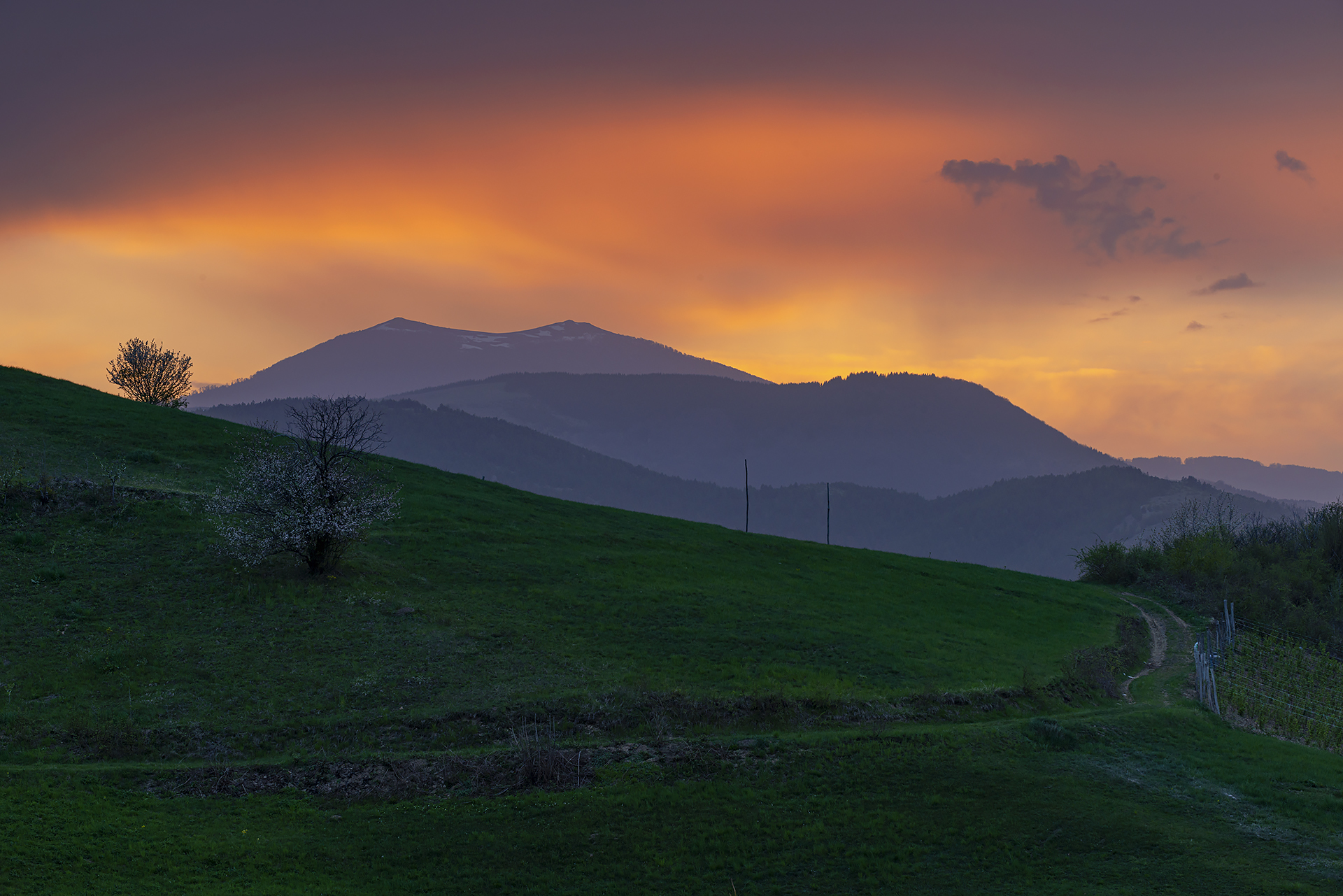
ABOVE: Koznik at sunset
From the Old Writings
“To the north of Nerađa, on the right side of the Rasina River, but high above it, on a looped hilltop, accessible with ease only from one side, this strange little town is built. It is said that, when it was being built, stones were hauled by goats, and that a goatling bleated from within its mother’s womb due to the heavy load. Another story says that those who were besieging the town smeared the goats’ horns with some kind of fuel, set them on fire, and then let the goats go up the slope. The besieged got frightened of that and surrendered.
The hilltop, on which Koznik stands, is 2,725 feet high, according to Ami Boué. Koznik’s wall still holds up very well. The entrance gate still stands, as do the five square towers on the side. Its interior is quite spacious, though uneven because of the rocks it was built upon.
From Koznik, there is a wonderful view in all directions, as far as the eye can see. They say that even our fathers, during their fighting for liberty, held their sentries there, who kept watch over the enemy’s movements.”
(From the book by Milan Đ. Milićević, The Principality of Serbia, published in Belgrade in 1876)

ABOVE: Koznik is considered one of the most beautiful and photogenic Serbian fortresses
The Lake of Jerina the Damned
“In our folklore, Koznik is known as the Jerina’s town. According to a tale, it was built by Jerina the Damned, later called out as “The Mighty One,” who was remembered for her coldness and insensitivity. Upon her request and will, a large dam was built next to the bridge of Koznica, where the “Skačak” tavern stands today, which dammed up the water and created a lake. This lake stretched to the north across Pleš, all the way to Mitrovo Polje, where even now, in the hamlet Čolići, one can find moorings in the shape of iron rings for ships in which Jerina once used to sail.
Below the place called Skačak, there is believed to be a tunnel that once led to the fortress on the hill, beneath which an even larger underground city is hidden. According to the story, a golden carriage lies in the passage, but the local folks are reluctant to speak of it, fearing an evil fate. Recently, one of the villagers, who dared to search for the mysterious tunnel, lost his mind and soon died after the discovery, overwhelmed by what he saw and experienced inside.”
(As recounted by Jasna Vujisić from the village of Koznica, 2019)
List of References
- Lj. Vasiljević, Tvrdi grad Koznik, Feljton: Arheološka istraživanja kruševačkog kraja (23), Štampani nedeljnik Grad broj 126, Kruševac, 24. septembar 2004, 22.
- “Srednjovekovni grad Koznik”, Informacioni sistem nepokretnih kulturnih dobara
- Amedoski D, Petrović В. “Tvrdjava Koznik – od prvog pomena do kraja 16. veka”, Vojnoistorisjki glasnik. 2011; 2: 127-137.
Translation: Marija Stamenković
Photo Gallery


Explore nearby fortresses

Brvenik

Grabovac